Autonomes Drone-in-a-Box-System für 24/7-Drohneneinsätze in Industrie, Energieversorgung, BOS, Polizei und Sicherheitsanwendungen.
€10.714,29zzgl. MwSt.€12.750,01inkl. MwSt.
Preis von: BSS B2B
€10.714,29
Drohneneinsätze rund um die Uhr ohne Personal vor Ort
Automatisierte Inspektionen und Sicherheitsflüge auf Knopfdruck
Optimiert für DJI Matrice 4D und Matrice 4TD
Schnellere Lageerfassung durch Echtzeitdaten aus der Luft
Ideal für KRITIS, Industrie, BOS und Perimeterschutz
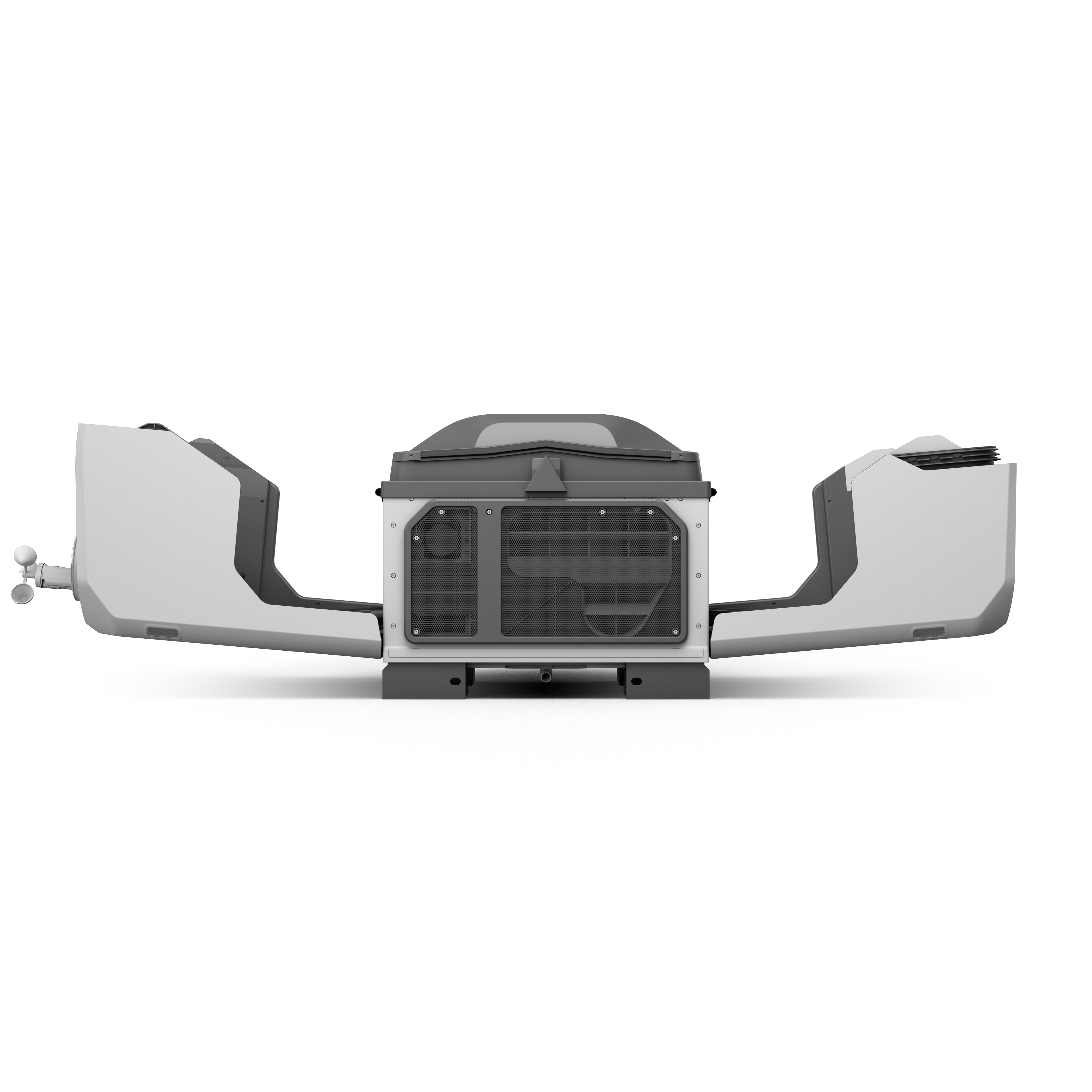
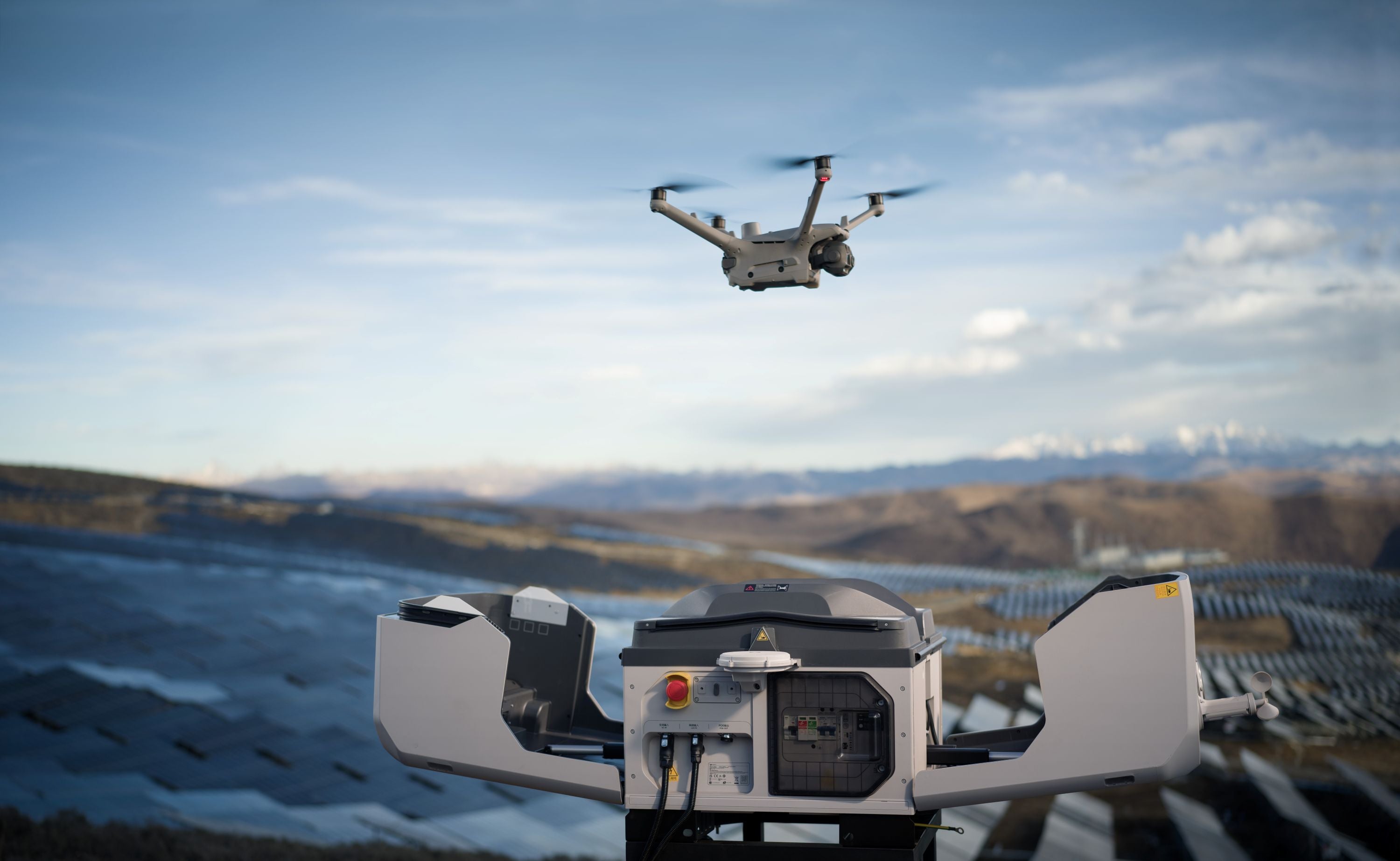
The DJI Dock 3 is a professional "drone-in-a-box" solution for round-the-clock autonomous drone operations. The system automatically handles takeoff, landing, battery management, and mission planning, enabling recurring flights without on-site personnel. When used with the DJI Matrice 4D or DJI Matrice 4TD, inspections, security tasks, and surveillance missions are efficiently automated. Industrial companies, energy providers, first responders, law enforcement, and infrastructure operators benefit from faster response times, continuous data collection, and significantly reduced operating costs. The DJI Dock 3 lays the foundation for scalable, secure, and highly available drone missions.
Hersteller:
DJI GmbH
Industriestrasse 12
97618 Niederlauer
Deutschland
support.eu@dji.com
SZ DJI Technology Co.,Ltd
Lobby of T2, DJI Sky City, No. 53 Xianyuan Road, Xili Community, Xili Street, Nanshan District
518057 Shenzhen
China
support@dji.com
Zwischenhändler:
Globe Flight GmbH
Borsigstrasse 7
93092 Barbing
Deutschland
info@globe-flight.de
Produkteigenschaften
Construction, Plant Security, Industry, Energy, Law Enforcement, Police
Intended Use
IP56
Protection Class
55.00 kg
Weight
62.70 kg
Shipping Weight
Item No. / GTIN
10437 | 6937224133778
DJI Dock 3
€10.714,29zzgl. MwSt.€12.750,01inkl. MwSt.
Preis von: BSS B2B
€10.714,29
Support von Droniq
Willkommen in unserer Hilfeübersicht. Wir haben die wichtigsten Themen für Sie übersichtlich zusammengefasst:
Versandinformationen
Kostenloser Versand ab 2.700 € innerhalb Deutschlands. Ausgenommen Gefahrgut- & Speditions-Versand.
Kundensupport
Sie erreichen unseren Customer Service über unser Kontaktformular.
FAQ’s
Antworten auf alle wichtigen Fragen finden Sie hier – schnell & klar.
Kundenbereich
Ihr Bereich für Bestellungen und individuelle Konditionen.
Einsatzzweck
Das DJI Dock 3 ermöglicht vollautomatisierte Drohneneinsätze für Bauüberwachung, Werkschutz, Industrieanlagen, Energieversorger, BOS und Polizei. In Kombination mit der DJI Matrice 4D oder Matrice 4TD können wiederkehrende Inspektionen, Baustandskontrollen, Sicherheitsrundflüge und Lageerkundungen vollständig automatisiert durchgeführt werden. Das System unterstützt die kontinuierliche Überwachung kritischer Infrastruktur, großer Industrieareale und sensibler Sicherheitsbereiche und liefert jederzeit aktuelle Luft- und Einsatzdaten.
Lieferumfang
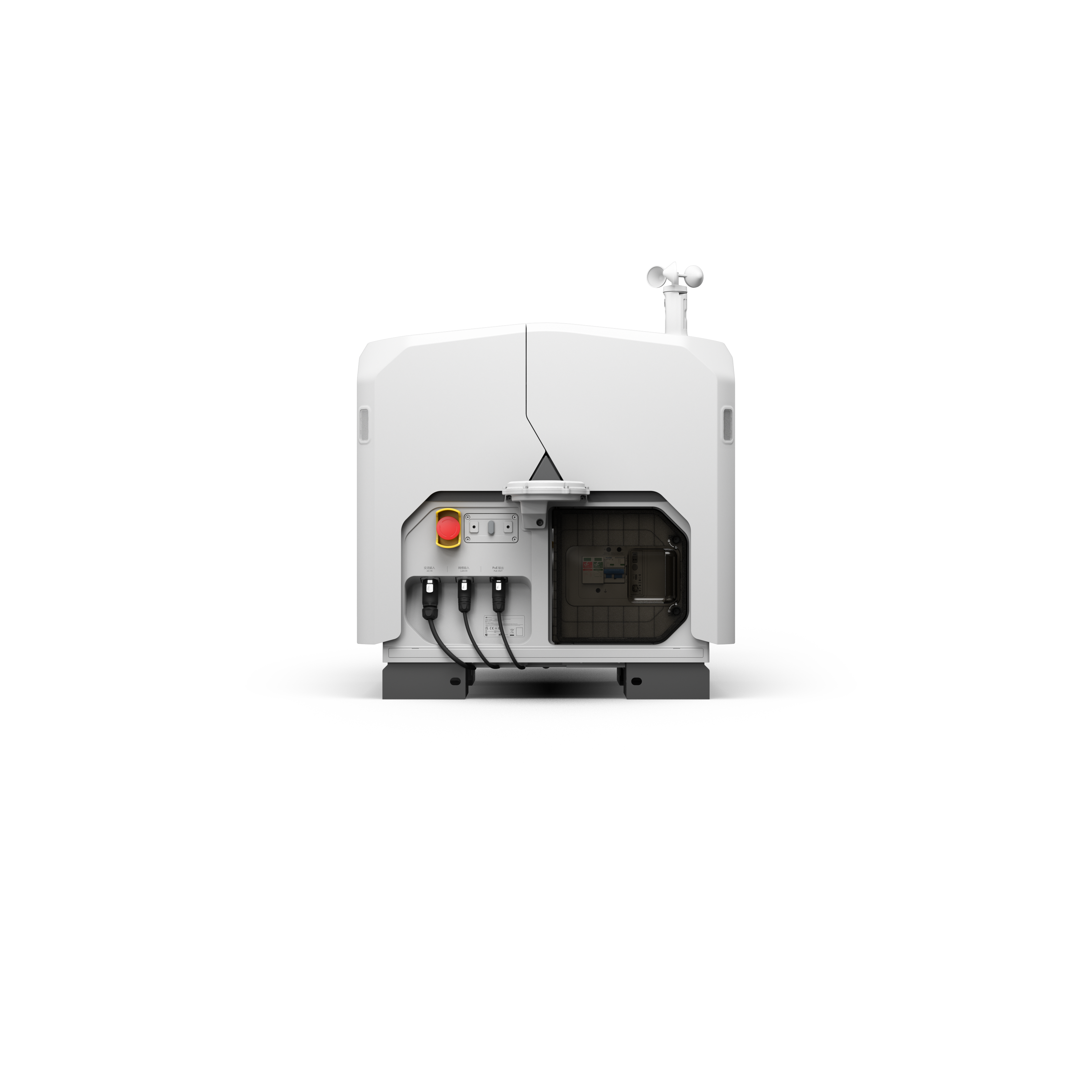
1x DJI Dock 3 (inkl. Erdungsdraht)
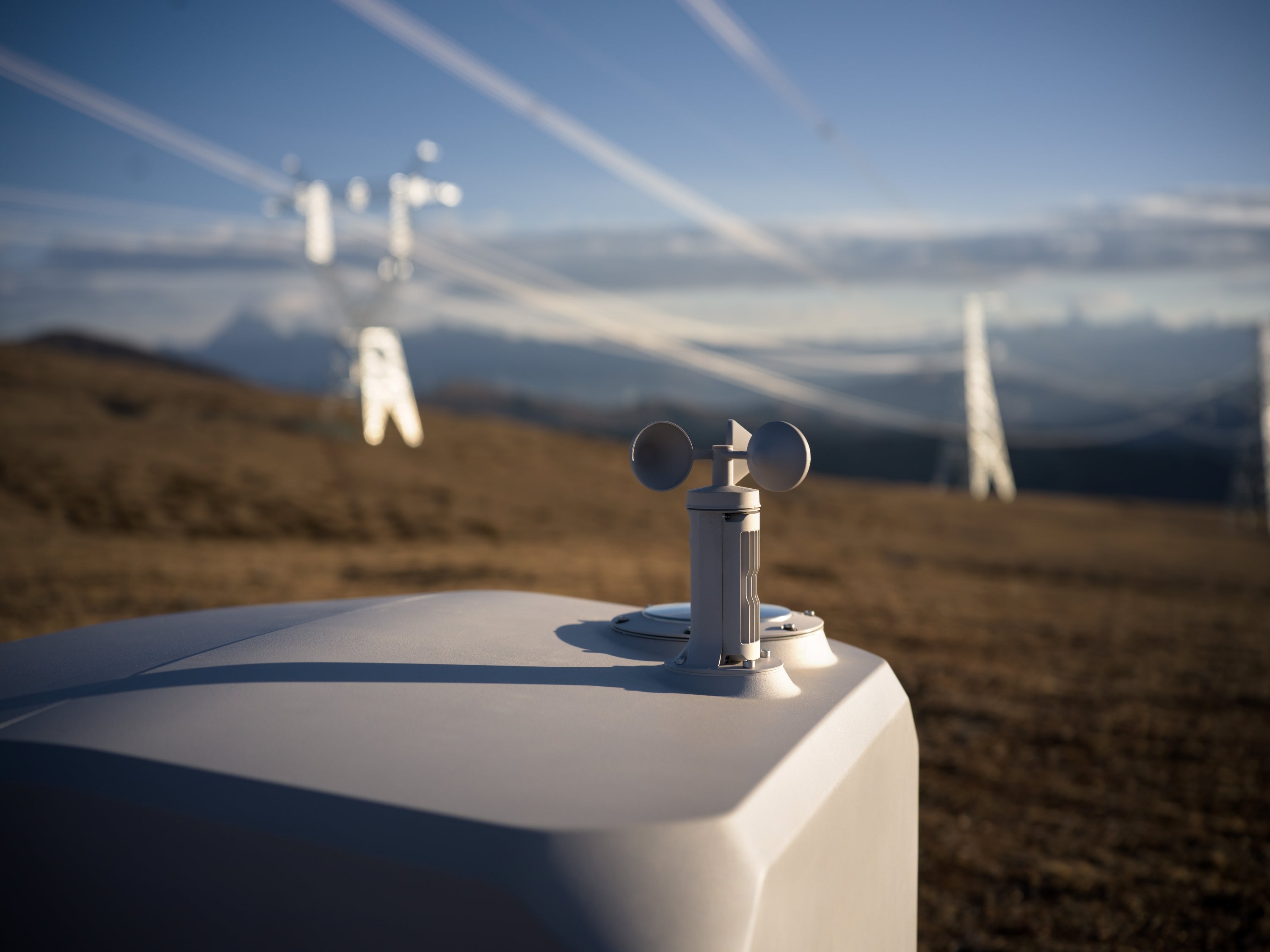
1x Windgeschwindigkeitsmessmodul
4x Erweiterungsbolzen
1x Ethernet-Kabelverbinder
1x Netzkabelverbinder
6x Aderendhülse
Schrauben und Werkzeuge
Hinweis:
Bitte beachten Sie, dass Folgendes nicht im Preis inbegriffen ist und zusätzlich erworben werden muss:
Akkus
RC Plus 2
Inbetriebnahme
Transport
Fluggerät DJI Matrice M4D oder DJI Matrice M4TD
Wir bieten neben der DJI Dock 3 auch Pakete an, die zudem noch ein Betriebskonzept samt Betriebsgenehmigung enthalten.
Technische Daten & Informationen
Aircraft
Unmanned Aerial Vehicle
DJI Matrice M4D
DJI Matrice M4TD
Weight (including two batteries)
1850 g
This figure includes the weight of the battery, propellers, and a microSD card, but does not include third-party payloads. The actual weight may vary due to differences in batch materials and external factors.
1850 g
This value includes the weight of the battery, propellers, and a microSD card, but does not include third-party payloads. The actual weight may vary due to differences in batch materials and external factors.
Max. Takeoff Weight
2090 g
2090 g
Dimensions
377.7 × 416.2 × 212.5 mm (L × W × H, without propellers)
377.7 × 416.2 × 212.5 mm (L × W × H, without propeller)
Diagonal length
Diagonal wheelbase: 498.5 mm Wheelbase between the left and right front motors: 383.0 mm Wheelbase between the left and right rear motors: 343.0 mm Front-to-rear wheelbase: 341.6 mm
Diagonal wheelbase: 498.5 mm Wheelbase between the left and right front motors: 383.0 mm Wheelbase between the left and right rear motors: 343.0 mm Front-to-rear wheelbase: 341.6 mm
Max. climbing speed
6 m/s (Normal mode) 10 m/s (Sport mode)
6 m/s (Normal mode) 10 m/s (Sport mode)
Max. descent rate
6 m/s (Normal mode) 8 m/s (Sport mode)
6 m/s (Normal mode) 8 m/s (Sport mode)
Maximum speed (on NHN, in calm conditions
Normal Mode, with obstacle detection enabled: 15 m/s flying forward, 12 m/s flying backward, 10 m/s flying sideways; Sport Mode: 21 m/s flying forward, 19 m/s flying backward, 15 m/s flying
sideways. When used with the DJI Dock, only Normal Mode is supported.
Normal mode, with obstacle detection enabled: 15 m/s flying forward, 12 m/s flying backward, 10 m/s flying sideways; Sport mode: 21 m/s flying forward, 19 m/s flying backward, 15 m/s flying
sideways. When used with the DJI Dock, only Normal Mode is supported.
Max. Wind Resistance
During operation: 12 m/s During takeoff/landing: 12 m/s
During operation: 12 m/s During takeoff/landing: 12 m/s
Max. Takeoff Altitude
6,500 m
6,500 m
Max. flight time
54 minutes
Tested in a controlled environment. The specific test conditions are as follows: Forward flight at a constant speed of 12 m/s in a windless laboratory environment at an altitude of 20 meters above sea level, in photo mode (without taking photos during flight), with obstacle avoidance disabled and a battery level ranging from 100% to 0%. Actual results may vary depending on the environment, usage, and firmware version.
54 minutes
Tested in a controlled environment. The specific test conditions are as follows: forward flight at a constant speed of 12 m/s in a windless laboratory environment at an altitude of 20 meters above sea level, in photo mode (without taking photos during flight), with obstacle avoidance turned off and a battery level ranging from 100% to 0%. Actual results may vary depending on the environment, usage, and firmware version.
Max. Hover Time
47 minutes
Measured using DJI Matrice 4D series drones hovering in a windless environment at an altitude of 20 meters above sea level, with a battery level ranging from 100% to 0%. Actual results may vary depending on the environment, usage, and firmware version.
47 minutes
Measured with DJI Matrice 4D series drones hovering in a windless environment at an altitude of 20 meters above sea level, with a battery level ranging from 100% to 0%. Actual results may vary depending on the environment, usage, and firmware version.
Max. operating radius
10 km
Measured at approximately 25 °C with a battery level of 15% of the spare battery, in a windless environment, at a circular flight speed of approximately 15 m/s, and while hovering for 18 minutes. Actual results may vary depending on the environment, usage, and firmware version.
10 km
Measured at approximately 25 °C with the spare battery at 15% charge, in a windless environment, at a cruising speed of approximately 15 m/s, and with a hover time of 18 minutes. Actual results may vary depending on the environment, usage, and firmware version.
Max. flight distance
43 km
Measured using a Matrice 4D/4TD flying at a constant speed of 16 m/s in a windless environment at 20 meters above sea level, with the battery level ranging from 100% to 0%. Actual results may vary depending on the environment, usage, and firmware version.
43 km
Measured using a Matrice 4D/4TD flying at a constant speed of 16 m/s in a windless environment at 20 meters above sea level, with the battery level ranging from 100% to 0%. Actual results may vary depending on the environment, usage, and firmware version.
Max. pitch angle
25° (Normal mode) 30° (Sport mode)
25° (Normal mode) 30° (Sport mode)
Max. angular velocity
200°/s
200°/s
Global Navigation Satellite System
GPS + BeiDou + Galileo + QZSS + GLONASS (QZSS and GLONASS are supported only when the RTK module is enabled.)
GPS + BeiDou + Galileo + QZSS + GLONASS (QZSS and GLONASS are supported only when the RTK module is enabled.)
Hovering accuracy (no wind or windy)
Vertical: ±0.1 m (with line-of-sight positioning) ±0.5 m (with GNSS positioning) ±0.1 m (with RTK positioning)
Horizontal: ±0.3 m (with line-of-sight positioning) ±0.5 m (with GNSS positioning) ±0.1 m (with RTK positioning)
Vertical: ±0.1 m (with line-of-sight positioning) ±0.5 m (with GNSS positioning) ±0.1 m (with RTK positioning)
Horizontal: ±0.3 m (with line-of-sight positioning) ±0.5 m (with GNSS positioning) ±0.1 m (with RTK positioning)
Field of view: 84° Equivalent focal length: 24 mm Aperture: f/2.8 to f/11 Focus: 1 m to ∞
Field of view: 82° Equivalent focal length: 24 mm Aperture: f/1.7 Focus: 1 m to ∞
Lens (medium telephoto camera)
Field of view: 35° Equivalent focal length: 70 mm Aperture: f/2.8 Focus: 3 m to ∞
Field of view: 35° Equivalent focal length: 70 mm Aperture: f/2.8 Focus: 3 m to ∞
Lens (Telephoto Camera)
Field of view: 15° Equivalent focal length: 168 mm Aperture: f/2.8 Focus: 3 m to ∞
Field of view: 15° Equivalent focal length: 168 mm Aperture: f/2.8 Focus: 3 m to ∞
Lens Defogging
Wide-angle, medium telephoto, and telephoto cameras all support lens defogging
Wide-angle, medium telephoto, and telephoto cameras all support lens defogging
ISO
Normal mode: ISO 100 to 25
,600 Night mode: Wide-angle camera: ISO 100 to 204 ,800 Medium telephoto camera: ISO 100 to 409,600 Telephoto camera: ISO 100 to 409,600
Normal mode: ISO 100 to 25
,600 Night mode: Wide-angle camera: ISO 100 to 409,600 Medium telephoto camera: ISO 100 to 409 ,600 Telephoto camera: ISO 100 to 819,200
Shutter speed
Wide-angle camera: Electronic shutter: 2 to 1/8000 s Mechanical shutter: 2 to 1/2000 s Medium telephoto camera: 2 to 1/8000 s Telephoto camera: 2 to 1/8000 s
Normal incidence range: 1,800 m (1 Hz) at a target reflectivity of 20%* Oblique incidence range (1:5 oblique angle): 600 m (1 Hz) Blind zone: 1 m Distance measurement accuracy: 1 m to 3 m: System error < 0.3 m, random error < 0.1 m for 1σ Other distances: ±(0.2 + 0.0015D) (target distance in meters)
* Performance may be reduced in rain or fog.
Normal incidence range: 1,800 m (1 Hz) at a target reflectance of 20%* Oblique incidence range (1:5 oblique angle): 600 m (1 Hz) Blind zone: 1 m Distance measurement accuracy: 1 m to 3 m: System error < 0.3 m, random error < 0.1 m for 1σ Other distances: ±(0.2 + 0.0015D) (target distance in meters)
* Performance may be reduced in rain or fog.
Thermal imaging camera
Thermal Imaging Camera
DJI Matrice M4D
DJI Matrice M4DT
Thermal imaging sensor
-
Uncooled VOx microbolometer
DO NOT expose the infrared camera’s lenses to intense energy sources such as the sun, lava, or laser beams. Doing so may cause permanent damage to the camera sensor.
Resolution
-
640 × 512
Pixel pitch
-
12 μm
Frame rate
-
30 Hz
Lens
-
Diagonal field of view: 45° Equivalent focal length: 53 mm Aperture: f/1.0 Focus: 5 m to ∞
Sensitivity
-
≤ 50 mk at f/1.0
Temperature measurement method
-
Spot measurement, area measurement
Temperature measurement range
-
-20 °C to 150 °C (high gain mode) 0° to 500 °C (low gain mode)
Palette
-
White Hot/Black Hot/Tint/Iron Red/Hot Iron/Arctic/Medical/Fulgurite/Rainbow 1/Rainbow 2
Photo format
-
JPEG (8-bit) R-JPEG (16-bit)
Video resolution
-
1280×1024 at 30 fps (CLOCK infrared image function enabled, Night Scene mode disabled) Other conditions: 640 × 512 at 30 fps
Video bitrate
-
6.5 Mbit/s (H.264 640 × 512 at 30 fps) 5 Mbit/s (H.265 640 × 512 at 30 fps) 12 Mbit/s (H.264 1280 × 1024 at 30 fps) 8 Mbit/s (H.265 1280 × 1024 at 30 fps)
Video format
-
MP4
Photo Modes
-
Single shot Normal mode: 640 × 512 Night Vision mode: 1280 × 1024
Interval Normal mode: 640 × 512, 0.7/1/2/3/5/7/10/15/20/30/60 s Clock infrared image mode: 1280 × 1024, 0.7/1/2/3/5/7/10/15/20/30/60 s
Digital zoom
-
28x
Infrared wavelength
-
8 to 14 μm
Infrared temperature measurement accuracy
-
High gain: ±2 °C or ±2%, whichever is greater Low gain: ±5 °C or ±3%, whichever is greater
Gimbal
Gimbal
DJI Matrice M4D
DJI Matrice M4TD
Stabilization
Mechanical 3-axis gimbal (tilt, roll, pan)
Mechanical 3-axis gimbal (tilt, roll, pan)
Mechanical Range
Tilt: -140° to +50° Roll: -52° to +52° Pan: -65° to +65°
Tilt: -140° to +113° Roll: -52° to +52° Yaw: -65° to +65°
Controllable range
Tilt: -90° to +35° Swivel: Not controllable
Tilt: -90° to +90°* Pan: Not
controllable* When the DJI Matrice 4TD gimbal is tilted upward at an angle between +70° and +90°, the wide-angle camera, the medium telephoto camera, and the infrared thermal imaging camera are obscured by the drone’s body.
Max. Control Speed (Tilt)
100°/s
100°/s
Angular oscillation range
±0.005°
±0.005°
Detection
Recognition
DJI Matrice M4D
DJI Matrice M4TD
Detection System
Omnidirectional dual vision sensors, supplemented by a 3D infrared sensor on the underside of the aircraft.
Omnidirectional dual vision sensors, supplemented by a 3D infrared sensor on the underside of the aircraft.
Forward
Measurement range: 0.5 m to 20 m Detection range: 0.5 m to 200 m Effective detection speed: Flight speed ≤ 15 m/s Field of view: Horizontal: 95°, vertical: 90°
Measurement range: 0.5 m to 20 m Detection range: 0.5 m to 200 m Effective detection speed: Flight speed ≤ 15 m/s Field of view: Horizontal: 95°, vertical: 90°
Rear
Measuring range: 0.5 m to 20 m Effective detection speed: Flight speed ≤ 12 m/s Field of view: Horizontal: 95°, vertical: 90°
Measurement range: 0.5 m to 20 m Effective detection speed: Flight speed ≤ 12 m/s Field of view: Horizontal: 95°, vertical: 90°
Side
Measuring range: 0.5 m to 16 m Effective detection speed: Flight speed ≤ 10 m/s Field of view: Horizontal: 90°, vertical: 90°
Measuring range: 0.5 m to 16 m Effective detection speed: Flight speed ≤ 10 m/s Field of view: Horizontal: 90°, vertical: 90°
Upward
Measuring range: 0.5 m to 20 m Effective detection speed: Flight speed ≤6 m/s Field of view: Front and rear 95°, left and right 90°
Measuring range: 0.5 m to 20 m Effective detection speed: Flight speed ≤6 m/s Field of view: Front and rear 95°, left and right 90°
Downward
Measuring range: 0.5 m to 16 m Effective detection speed: Flight speed ≤6 m/s Field of view: 90° front and rear, 95° left and right
Measuring range: 0.5 m to 16 m Effective detection speed: Flight speed ≤6 m/s Field of view: 90° forward and backward, 95° left and right
Operating Environment
Front, rear, top, and bottom: Surfaces with discernible patterns under adequate lighting conditions (lux > 0.1) Left and right: Surfaces with diffuse reflectance > 20% (e.g., walls, trees, people) and adequate lighting (lux > 6)
Front, rear, top, and bottom: Surfaces with discernible patterns under adequate lighting conditions (lux > 0.1) Left and right: Surfaces with diffuse reflectance > 20% (e.g., walls, trees, people) and adequate lighting (lux > 6)
Video Transmission
Video Transmission
DJI Matrice M4D
DJI Matrice M4DT
Video Transmission System
DJI O4+ Enterprise
DJI O4+ Enterprise
Live View Quality
720p/30fps, 1080p/30fps (with DJI RC Plus 2 Enterprise) 540p/30fps, 720p/30fps, 1080p/30fps (with DJI Dock 3 and DJI FlightHub 2)
720p/30fps, 1080p/30fps (with DJI RC Plus 2 Enterprise) 540p/30fps, 720p/30fps, 1080p/30fps (with DJI Dock 3 and DJI FlightHub 2)
Operating frequency
2.400 to 2.4835 GHz 5.150 to 5.250 GHz (CE: 5.170 to 5.250 GHz) 5.725 to 5.850 GHz
Supported operating frequency bands and their availability vary by country/region. For more details, refer to local laws and regulations.
2.400 to 2.4835 GHz 5.150 to 5.250 GHz (CE: 5.170 to 5.250 GHz) 5.725 to 5.850 GHz
The supported operating frequency bands and their availability vary by country/region. For more details, refer to local laws and regulations.
Max. transmission range (without obstacles or interference)
FCC: 25 km CE: 12 km SRRC: 12 km MIC: 12 km
Measured in an outdoor environment without obstacles or interference. The data above shows the maximum one-way communication range for each standard, excluding the return flight. During flight, always heed the return-to-home warning in DJI FlightHub 2 or the DJI Pilot app.
FCC: 25 km CE: 12 km SRRC: 12 km MIC: 12 km
Measured in an outdoor environment without obstacles or interference. The data above shows the maximum one-way communication range for each standard, excluding the return flight. During flight, always heed the return-to-home warning displayed in DJI FlightHub 2 or the DJI Pilot app.
Max. Transmission Range (without obstacles, with interference)
Severe interference (e.g., dense urban areas, residential areas): 1.5 to 5 km Moderate interference (suburban areas, city parks, etc.): 5 to 15 km Low interference (open areas, remote areas, etc.): 15 to 25 km
The data was tested in accordance with FCC standards in unobstructed environments with typical interference. This is for reference only and does not guarantee the actual flight distance. In environments with obstacles, it is recommended to install the D-RTK 3 Relay (fixed-installation version).
Max. Download Speed
20 MB/s (with DJI Dock 3) 20 MB/s (with DJI RC Plus 2 Enterprise)
Measured in a low-interference laboratory environment in countries/regions that support both 2.4 GHz and 5.8 GHz. Download speeds may vary depending on actual conditions.
20 MB/s (with DJI Dock 3) 20 MB/s (with DJI RC Plus 2 Enterprise)
Measured in a laboratory environment with low interference in countries/regions that support both 2.4 GHz and 5.8 GHz. Download speeds may vary depending on actual conditions.
Lowest latency
The latency for video transmission from the aircraft to the dock is approximately 100 milliseconds (depending on actual environmental conditions). The latency for video transmission from the dock to the DJI FlightHub 2 is affected by actual network conditions and the computer’s configuration.
The latency for video transmission from the aircraft to the dock is approximately 100 milliseconds (depending on actual environmental conditions). The latency for video transmission from the dock to the DJI FlightHub 2 is influenced by actual network conditions and the computer’s configuration.
Supports charging at low temperatures via the heating function
Supports charging at low temperatures via the heating function
Power Supply
Power Supply
DJI Matrice M4D
DJI Matrice M4TD
Input
100 to 240 V (AC), 50/60 Hz, 3 A
100 to 240 V (AC), 50/60 Hz, 3 A
Output Power
240 W
240 W
Output
Total: 240 W maximum output power; USB-C port: 65 W maximum output power
. When charging via two ports simultaneously, the maximum output power of the USB-C port is 45 W.
Total: 240 W maximum output power; USB-C port: 65 W maximum output power
. When charging via two ports simultaneously, the maximum output power of the USB-C port is 45 W.
Battery Charging Station
Battery Charging Station
DJI Matrice M4D
DJI Matrice M4TD
Input
SDC: 16.8 V to 25.5 V, 12.1 A
SDC: 16.8 V to 25.5 V, 12.1 A
Output
240 W
240 W
Rated power
3 batteries are charged sequentially Supports Standard Mode (100% battery charge) and Ready-to-Fly Mode (90% battery charge)
3 batteries are charged one after another; supports Standard Mode (100% battery charge) and Ready-to-Fly Mode (90% battery charge)
Charging Type
DJI Matrice 4D Series - Battery
DJI Matrice 4D Series - Battery
Charging Temperature
5 °C to 40 °C
5 °C to 40 °C
25 km Radius
32 min Flugzeit
Anwendungsbereich
DJI Dock 3
Das DJI Dock 3 bietet maximale Flexibilität für automatisierte Drohnenmissionen und kann sowohl stationär als auch fahrzeugmontiert eingesetzt werden. In Kombination mit dem D-RTK 3 Relais lässt sich die Signalqualität verbessern und die Kommunikationsreichweite auf bis zu 25 km erweitern. Dadurch eignet sich das System besonders für Einsätze an erhöhten Standorten wie Hochhäusern, Sendemasten oder in weitläufigen Einsatzgebieten.
Erstmals unterstützt die Dockingstation auch den mobilen Betrieb auf Fahrzeugen. Dies ermöglicht flexible Einsätze beispielsweise bei Notfällen, Inspektionen oder temporären Überwachungsaufgaben. Über DJI FlightHub 2 können Missionen aus der Ferne geplant, überwacht und verwaltet werden.
Für einen kontinuierlichen Betrieb lassen sich zwei DJI Dock 3 Systeme auf einem Fahrzeug installieren. Durch den automatisierten Wechselbetrieb der Drohnen wird eine nahezu unterbrechungsfreie Live-Übertragung ermöglicht. Optional können die Drohnen zudem mit Scheinwerfern ausgestattet werden, um Einsätze bei Dunkelheit oder in Notfallsituationen effektiv zu unterstützen.
Das DJI Dock 3 kann stationär oder mobil eingesetzt werden und passt sich flexibel an verschiedene Einsatzszenarien an. Dadurch lassen sich automatisierte Drohnenmissionen auch an wechselnden Standorten effizient realisieren.
Geprüfte Sicherheit
Geprüfte Sicherheit
FlightHub 2 unterstützt einen sicheren und normgerechten Drohnenbetrieb. Durch umfassende Sicherheitsfunktionen, flexible Zugriffsverwaltung und stabile Datenübertragungen werden hohe Anforderungen an Datenschutz, Flugsicherheit und Compliance erfüllt.
Temperaturbeständig
Temperaturbeständig
Das DJI Dock 3 wurde für den Einsatz unter anspruchsvollen Temperaturbedingungen entwickelt. Ob große Hitze oder eisige Kälte, die Dockingstation gewährleistet einen zuverlässigen Betrieb und unterstützt sichere Drohneneinsätze auch in herausfordernden Umgebungen.
Wetterfest & leistungsstark
Wetterfest & leistungsstark
Das DJI Dock 3 sowie die Matrice 4D und 4TD sind für anspruchsvolle Wetterbedingungen ausgelegt. Hohe Windstabilität, robuste Schutzfunktionen und Anti-Eis-Propeller ermöglichen zuverlässige Flüge sowie sichere Starts und Landungen auch bei Wind, Kälte und Niederschlag.
Häufige Fragen zur DJI Dock 3
Was ist das DJI Dock 3?
Das DJI Dock 3 ist eine automatische Drohnengarage für den autonomen Betrieb von DJI Enterprise-Drohnen. Es ermöglicht Start, Landung, Aufladung und Missionsmanagement ohne manuellen Eingriff.
Mit welchen Drohnen ist das DJI Dock 3 kompatibel?
Das DJI Dock 3 wurde für den Einsatz mit der DJI Matrice 4D und DJI Matrice 4TD entwickelt.
Für welche Anwendungen eignet sich das DJI Dock 3?
Das System eignet sich für Bauüberwachung, Werkschutz, Industrieinspektionen, Energieversorgungsanlagen, BOS-Einsätze, Polizei sowie die Überwachung kritischer Infrastruktur.
Welche Vorteile bietet ein autonomes Drone-in-a-Box-System?
Automatisierte Abläufe ermöglichen regelmäßige Inspektionen, schnellere Reaktionszeiten und eine permanente Verfügbarkeit von Luftdaten ohne Vor-Ort-Personal.
Eignet sich das DJI Dock 3 für Sicherheitsanwendungen?
Ja. Das DJI Dock 3 unterstützt Perimeterschutz, Werkschutz, Lageerkundung, Objektschutz und die Überwachung kritischer Infrastruktur rund um die Uhr.
Choosing a selection results in a full page refresh.