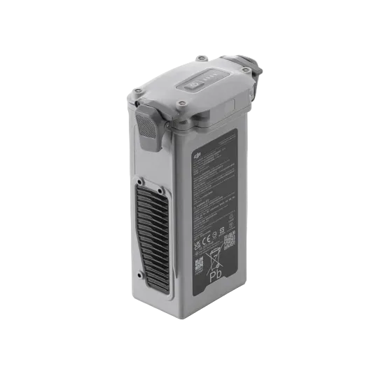
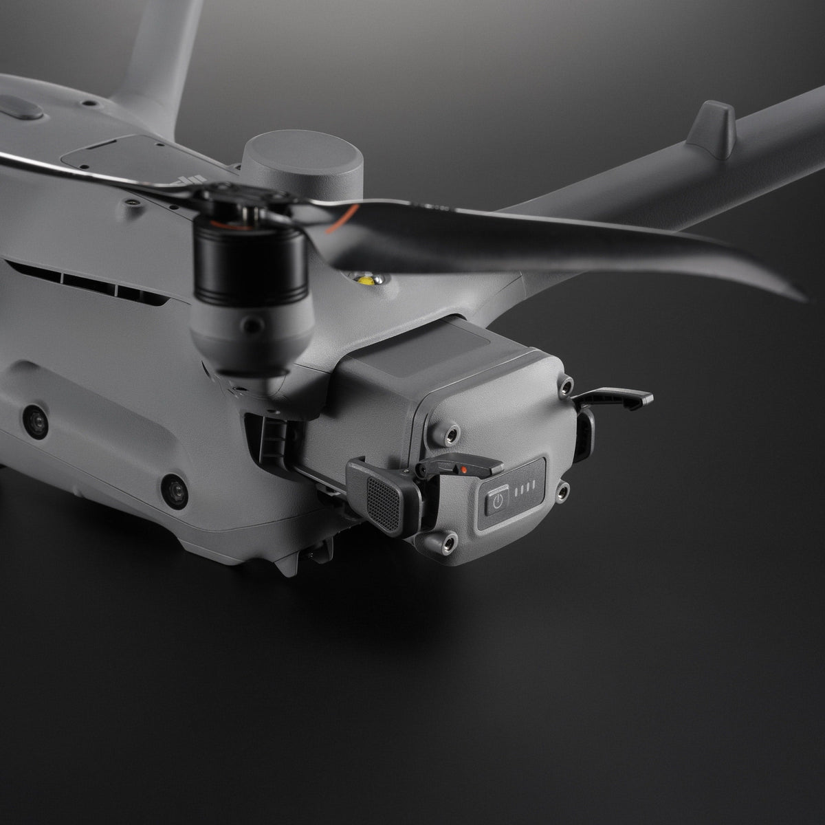
Präzise Dock-Drohne für Kartierung, Inspektion und automatisierte Enterprise-Missionen.
€4.100,00zzgl. MwSt.€4.879,00inkl. MwSt.
Preis von: BSS B2B
€4.100,00
Speziell für DJI Dock 3 entwickelt
Präzise Kartierung und Inspektion aus der Luft
Mehrkamerasystem mit Laser-Entfernungsmesser
KI-gestützte 3D-Routenplanung möglich
The DJI Matrice 4D was developed for professional inspection and surveillance tasks in critical infrastructure, energy supply, industry, and construction projects. Thanks to high-resolution camera technology, RTK precision, and automated flight missions, it is ideally suited for power lines, substations, industrial facilities, transportation routes, and continuous construction progress monitoring. When used in combination with the DJI Dock 3, the Matrice 4D enables recurring inspections, efficient data collection, and reliable documentation of large facilities and infrastructure.
Hersteller:
DJI GmbH
Industriestrasse 12
97618 Niederlauer
Deutschland
support.eu@dji.com
SZ DJI Technology Co.,Ltd
Lobby of T2, DJI Sky City, No. 53 Xianyuan Road, Xili Community, Xili Street, Nanshan District
518057 Shenzhen
China
support@dji.com
Zwischenhändler:
Globe Flight GmbH
Borsigstrasse 7
93092 Barbing
Deutschland
info@globe-flight.de
Produkteigenschaften
RGB
Camera Sensor
KRITIS, Energy, Infrastructure, Industrial Facilities, Construction
Intended Use
C2
Drone Class
IP55
Protection Class
54 min
Flight time
1.85 kg
Weight
3.00 kg
Shipping Weight
Item No. / GTIN
10437 | 6937224133778
DJI Matrice 4D
€4.100,00zzgl. MwSt.€4.879,00inkl. MwSt.
Preis von: BSS B2B
€4.100,00
Support von Droniq
Willkommen in unserer Hilfeübersicht. Wir haben die wichtigsten Themen für Sie übersichtlich zusammengefasst:
Versandinformationen
Kostenloser Versand ab 2.700 € innerhalb Deutschlands. Ausgenommen Gefahrgut- & Speditions-Versand.
Kundensupport
Sie erreichen unseren Customer Service über unser Kontaktformular.
FAQ’s
Antworten auf alle wichtigen Fragen finden Sie hier – schnell & klar.
Kontakt zu uns
Ihr Bereich für Bestellungen und individuelle Konditionen.
Einsatzzweck
Die DJI Matrice 4D wurde für professionelle Inspektions- und Überwachungsaufgaben in kritischer Infrastruktur, Energieversorgung, Industrie und Bauprojekten entwickelt. Dank hochauflösender Kameratechnologie, RTK-Präzision und automatisierter Flugmissionen eignet sie sich ideal für Stromtrassen, Umspannwerke, Industrieanlagen, Verkehrswege sowie die kontinuierliche Baustandsüberwachung. In Kombination mit DJI Dock 3 ermöglicht die Matrice 4D wiederkehrende Inspektionen, effiziente Datenerfassung und eine zuverlässige Dokumentation großer Anlagen und Infrastrukturen.
Lieferumfang
1x Fluggerät DJI Matrice 4D
Inkl. 1 Jahr DJI Care Enterprise Care
Inkl. DJI FTS
Optional: Akku & Fernsteuerung DJI RC Plus 2 Enterprise
Hinweis:
Die DJI Matrice M4D ist einzeln oder in der Kombination mit der Drohnengarage DJI Dock 3 einsetzbar. Einzeln kann die Matrice M4D in der speziellen Kategorie geflogen werden.
Empfehlung:
Nach 450 Flügen mit einem Satz Anti-Eis-Propellern wird empfohlen, die Propeller durch einen neuen Satz zu ersetzen, um den Schutz vor Vereisung aufrechtzuerhalten. Nach etwa einem Winter im Einsatz weisen die Anti-Eis-Propeller Kratzer und Abblätterungen an der Oberflächenbeschichtung auf, wodurch die Anti-Eis-Wirkung nachlässt. Sie können jedoch weiterhin als Standardpropeller verwendet werden. Bitte ersetzen Sie diese unbedingt vor dem nächsten Winter durch neue Propeller. Bei Einsatz unter normalen Temperaturbedingungen entspricht die Flugleistung von Anti-Eis-Propellern der von Standardpropellern (einschließlich Akkulaufzeit, Fluggeschwindigkeit usw.).
15 m/s schnell
47 min in der Luft
10 km weit
Technische Daten & Informationen
Aircraft
Unmanned Aerial Vehicle
DJI Matrice M4D
DJI Matrice M4TD
Weight (including two batteries)
1850 g
This figure includes the weight of the battery, propellers, and a microSD card, but does not include third-party payloads. The actual weight may vary due to differences in batch materials and external factors.
1850 g
This value includes the weight of the battery, propellers, and a microSD card, but does not include third-party payloads. The actual weight may vary due to differences in batch materials and external factors.
Max. Takeoff Weight
2090 g
2090 g
Dimensions
377.7 × 416.2 × 212.5 mm (L × W × H, without propellers)
377.7 × 416.2 × 212.5 mm (L × W × H, without propeller)
Diagonal length
Diagonal wheelbase: 498.5 mm Wheelbase between the left and right front motors: 383.0 mm Wheelbase between the left and right rear motors: 343.0 mm Front-to-rear wheelbase: 341.6 mm
Diagonal wheelbase: 498.5 mm Wheelbase between the left and right front motors: 383.0 mm Wheelbase between the left and right rear motors: 343.0 mm Front-to-rear wheelbase: 341.6 mm
Max. climbing speed
6 m/s (Normal mode) 10 m/s (Sport mode)
6 m/s (Normal mode) 10 m/s (Sport mode)
Max. descent rate
6 m/s (Normal mode) 8 m/s (Sport mode)
6 m/s (Normal mode) 8 m/s (Sport mode)
Maximum speed (on NHN, in calm conditions
Normal Mode, with obstacle detection enabled: 15 m/s flying forward, 12 m/s flying backward, 10 m/s flying sideways; Sport Mode: 21 m/s flying forward, 19 m/s flying backward, 15 m/s flying
sideways. When used with the DJI Dock, only Normal Mode is supported.
Normal mode, with obstacle detection enabled: 15 m/s flying forward, 12 m/s flying backward, 10 m/s flying sideways; Sport mode: 21 m/s flying forward, 19 m/s flying backward, 15 m/s flying
sideways. When used with the DJI Dock, only Normal Mode is supported.
Max. Wind Resistance
During operation: 12 m/s During takeoff/landing: 12 m/s
During operation: 12 m/s During takeoff/landing: 12 m/s
Max. Takeoff Altitude
6,500 m
6,500 m
Max. flight time
54 minutes
Tested in a controlled environment. The specific test conditions are as follows: Forward flight at a constant speed of 12 m/s in a windless laboratory environment at an altitude of 20 meters above sea level, in photo mode (without taking photos during flight), with obstacle avoidance disabled and a battery level ranging from 100% to 0%. Actual results may vary depending on the environment, usage, and firmware version.
54 minutes
Tested in a controlled environment. The specific test conditions are as follows: forward flight at a constant speed of 12 m/s in a windless laboratory environment at an altitude of 20 meters above sea level, in photo mode (without taking photos during flight), with obstacle avoidance turned off and a battery level ranging from 100% to 0%. Actual results may vary depending on the environment, usage, and firmware version.
Max. Hover Time
47 minutes
Measured using DJI Matrice 4D series drones hovering in a windless environment at an altitude of 20 meters above sea level, with a battery level ranging from 100% to 0%. Actual results may vary depending on the environment, usage, and firmware version.
47 minutes
Measured with DJI Matrice 4D series drones hovering in a windless environment at an altitude of 20 meters above sea level, with a battery level ranging from 100% to 0%. Actual results may vary depending on the environment, usage, and firmware version.
Max. operating radius
10 km
Measured at approximately 25 °C with a battery level of 15% of the spare battery, in a windless environment, at a circular flight speed of approximately 15 m/s, and while hovering for 18 minutes. Actual results may vary depending on the environment, usage, and firmware version.
10 km
Measured at approximately 25 °C with the spare battery at 15% charge, in a windless environment, at a cruising speed of approximately 15 m/s, and with a hover time of 18 minutes. Actual results may vary depending on the environment, usage, and firmware version.
Max. flight distance
43 km
Measured using a Matrice 4D/4TD flying at a constant speed of 16 m/s in a windless environment at 20 meters above sea level, with the battery level ranging from 100% to 0%. Actual results may vary depending on the environment, usage, and firmware version.
43 km
Measured using a Matrice 4D/4TD flying at a constant speed of 16 m/s in a windless environment at 20 meters above sea level, with the battery level ranging from 100% to 0%. Actual results may vary depending on the environment, usage, and firmware version.
Max. pitch angle
25° (Normal mode) 30° (Sport mode)
25° (Normal mode) 30° (Sport mode)
Max. angular velocity
200°/s
200°/s
Global Navigation Satellite System
GPS + BeiDou + Galileo + QZSS + GLONASS (QZSS and GLONASS are supported only when the RTK module is enabled.)
GPS + BeiDou + Galileo + QZSS + GLONASS (QZSS and GLONASS are supported only when the RTK module is enabled.)
Hovering accuracy (no wind or windy)
Vertical: ±0.1 m (with line-of-sight positioning) ±0.5 m (with GNSS positioning) ±0.1 m (with RTK positioning)
Horizontal: ±0.3 m (with line-of-sight positioning) ±0.5 m (with GNSS positioning) ±0.1 m (with RTK positioning)
Vertical: ±0.1 m (with line-of-sight positioning) ±0.5 m (with GNSS positioning) ±0.1 m (with RTK positioning)
Horizontal: ±0.3 m (with line-of-sight positioning) ±0.5 m (with GNSS positioning) ±0.1 m (with RTK positioning)
Field of view: 84° Equivalent focal length: 24 mm Aperture: f/2.8 to f/11 Focus: 1 m to ∞
Field of view: 82° Equivalent focal length: 24 mm Aperture: f/1.7 Focus: 1 m to ∞
Lens (medium telephoto camera)
Field of view: 35° Equivalent focal length: 70 mm Aperture: f/2.8 Focus: 3 m to ∞
Field of view: 35° Equivalent focal length: 70 mm Aperture: f/2.8 Focus: 3 m to ∞
Lens (Telephoto Camera)
Field of view: 15° Equivalent focal length: 168 mm Aperture: f/2.8 Focus: 3 m to ∞
Field of view: 15° Equivalent focal length: 168 mm Aperture: f/2.8 Focus: 3 m to ∞
Lens Defogging
Wide-angle, medium telephoto, and telephoto cameras all support lens defogging
Wide-angle, medium telephoto, and telephoto cameras all support lens defogging
ISO
Normal mode: ISO 100 to 25
,600 Night mode: Wide-angle camera: ISO 100 to 204 ,800 Medium telephoto camera: ISO 100 to 409,600 Telephoto camera: ISO 100 to 409,600
Normal mode: ISO 100 to 25
,600 Night mode: Wide-angle camera: ISO 100 to 409,600 Medium telephoto camera: ISO 100 to 409 ,600 Telephoto camera: ISO 100 to 819,200
Shutter speed
Wide-angle camera: Electronic shutter: 2 to 1/8000 s Mechanical shutter: 2 to 1/2000 s Medium telephoto camera: 2 to 1/8000 s Telephoto camera: 2 to 1/8000 s
Normal incidence range: 1,800 m (1 Hz) at a target reflectivity of 20%* Oblique incidence range (1:5 oblique angle): 600 m (1 Hz) Blind zone: 1 m Distance measurement accuracy: 1 m to 3 m: System error < 0.3 m, random error < 0.1 m for 1σ Other distances: ±(0.2 + 0.0015D) (target distance in meters)
* Performance may be reduced in rain or fog.
Normal incidence range: 1,800 m (1 Hz) at a target reflectance of 20%* Oblique incidence range (1:5 oblique angle): 600 m (1 Hz) Blind zone: 1 m Distance measurement accuracy: 1 m to 3 m: System error < 0.3 m, random error < 0.1 m for 1σ Other distances: ±(0.2 + 0.0015D) (target distance in meters)
* Performance may be reduced in rain or fog.
Thermal imaging camera
Thermal Imaging Camera
DJI Matrice M4D
DJI Matrice M4DT
Thermal imaging sensor
-
Uncooled VOx microbolometer
DO NOT expose the infrared camera’s lenses to intense energy sources such as the sun, lava, or laser beams. Doing so may cause permanent damage to the camera sensor.
Resolution
-
640 × 512
Pixel pitch
-
12 μm
Frame rate
-
30 Hz
Lens
-
Diagonal field of view: 45° Equivalent focal length: 53 mm Aperture: f/1.0 Focus: 5 m to ∞
Sensitivity
-
≤ 50 mk at f/1.0
Temperature measurement method
-
Spot measurement, area measurement
Temperature measurement range
-
-20 °C to 150 °C (high gain mode) 0° to 500 °C (low gain mode)
Palette
-
White Hot/Black Hot/Tint/Iron Red/Hot Iron/Arctic/Medical/Fulgurite/Rainbow 1/Rainbow 2
Photo format
-
JPEG (8-bit) R-JPEG (16-bit)
Video resolution
-
1280×1024 at 30 fps (CLOCK infrared image function enabled, Night Scene mode disabled) Other conditions: 640 × 512 at 30 fps
Video bitrate
-
6.5 Mbit/s (H.264 640 × 512 at 30 fps) 5 Mbit/s (H.265 640 × 512 at 30 fps) 12 Mbit/s (H.264 1280 × 1024 at 30 fps) 8 Mbit/s (H.265 1280 × 1024 at 30 fps)
Video format
-
MP4
Photo Modes
-
Single shot Normal mode: 640 × 512 Night Vision mode: 1280 × 1024
Interval Normal mode: 640 × 512, 0.7/1/2/3/5/7/10/15/20/30/60 s Clock infrared image mode: 1280 × 1024, 0.7/1/2/3/5/7/10/15/20/30/60 s
Digital zoom
-
28x
Infrared wavelength
-
8 to 14 μm
Infrared temperature measurement accuracy
-
High gain: ±2 °C or ±2%, whichever is greater Low gain: ±5 °C or ±3%, whichever is greater
Gimbal
Gimbal
DJI Matrice M4D
DJI Matrice M4TD
Stabilization
Mechanical 3-axis gimbal (tilt, roll, pan)
Mechanical 3-axis gimbal (tilt, roll, pan)
Mechanical Range
Tilt: -140° to +50° Roll: -52° to +52° Pan: -65° to +65°
Tilt: -140° to +113° Roll: -52° to +52° Yaw: -65° to +65°
Controllable range
Tilt: -90° to +35° Swivel: Not controllable
Tilt: -90° to +90°* Pan: Not
controllable* When the DJI Matrice 4TD gimbal is tilted upward at an angle between +70° and +90°, the wide-angle camera, the medium telephoto camera, and the infrared thermal imaging camera are obscured by the drone’s body.
Max. Control Speed (Tilt)
100°/s
100°/s
Angular oscillation range
±0.005°
±0.005°
Detection
Recognition
DJI Matrice M4D
DJI Matrice M4TD
Detection System
Omnidirectional dual vision sensors, supplemented by a 3D infrared sensor on the underside of the aircraft.
Omnidirectional dual vision sensors, supplemented by a 3D infrared sensor on the underside of the aircraft.
Forward
Measurement range: 0.5 m to 20 m Detection range: 0.5 m to 200 m Effective detection speed: Flight speed ≤ 15 m/s Field of view: Horizontal: 95°, vertical: 90°
Measurement range: 0.5 m to 20 m Detection range: 0.5 m to 200 m Effective detection speed: Flight speed ≤ 15 m/s Field of view: Horizontal: 95°, vertical: 90°
Rear
Measuring range: 0.5 m to 20 m Effective detection speed: Flight speed ≤ 12 m/s Field of view: Horizontal: 95°, vertical: 90°
Measurement range: 0.5 m to 20 m Effective detection speed: Flight speed ≤ 12 m/s Field of view: Horizontal: 95°, vertical: 90°
Side
Measuring range: 0.5 m to 16 m Effective detection speed: Flight speed ≤ 10 m/s Field of view: Horizontal: 90°, vertical: 90°
Measuring range: 0.5 m to 16 m Effective detection speed: Flight speed ≤ 10 m/s Field of view: Horizontal: 90°, vertical: 90°
Upward
Measuring range: 0.5 m to 20 m Effective detection speed: Flight speed ≤6 m/s Field of view: Front and rear 95°, left and right 90°
Measuring range: 0.5 m to 20 m Effective detection speed: Flight speed ≤6 m/s Field of view: Front and rear 95°, left and right 90°
Downward
Measuring range: 0.5 m to 16 m Effective detection speed: Flight speed ≤6 m/s Field of view: 90° front and rear, 95° left and right
Measuring range: 0.5 m to 16 m Effective detection speed: Flight speed ≤6 m/s Field of view: 90° forward and backward, 95° left and right
Operating Environment
Front, rear, top, and bottom: Surfaces with discernible patterns under adequate lighting conditions (lux > 0.1) Left and right: Surfaces with diffuse reflectance > 20% (e.g., walls, trees, people) and adequate lighting (lux > 6)
Front, rear, top, and bottom: Surfaces with discernible patterns under adequate lighting conditions (lux > 0.1) Left and right: Surfaces with diffuse reflectance > 20% (e.g., walls, trees, people) and adequate lighting (lux > 6)
Video Transmission
Video Transmission
DJI Matrice M4D
DJI Matrice M4DT
Video Transmission System
DJI O4+ Enterprise
DJI O4+ Enterprise
Live View Quality
720p/30fps, 1080p/30fps (with DJI RC Plus 2 Enterprise) 540p/30fps, 720p/30fps, 1080p/30fps (with DJI Dock 3 and DJI FlightHub 2)
720p/30fps, 1080p/30fps (with DJI RC Plus 2 Enterprise) 540p/30fps, 720p/30fps, 1080p/30fps (with DJI Dock 3 and DJI FlightHub 2)
Operating frequency
2.400 to 2.4835 GHz 5.150 to 5.250 GHz (CE: 5.170 to 5.250 GHz) 5.725 to 5.850 GHz
Supported operating frequency bands and their availability vary by country/region. For more details, refer to local laws and regulations.
2.400 to 2.4835 GHz 5.150 to 5.250 GHz (CE: 5.170 to 5.250 GHz) 5.725 to 5.850 GHz
The supported operating frequency bands and their availability vary by country/region. For more details, refer to local laws and regulations.
Max. transmission range (without obstacles or interference)
FCC: 25 km CE: 12 km SRRC: 12 km MIC: 12 km
Measured in an outdoor environment without obstacles or interference. The data above shows the maximum one-way communication range for each standard, excluding the return flight. During flight, always heed the return-to-home warning in DJI FlightHub 2 or the DJI Pilot app.
FCC: 25 km CE: 12 km SRRC: 12 km MIC: 12 km
Measured in an outdoor environment without obstacles or interference. The data above shows the maximum one-way communication range for each standard, excluding the return flight. During flight, always heed the return-to-home warning displayed in DJI FlightHub 2 or the DJI Pilot app.
Max. Transmission Range (without obstacles, with interference)
Severe interference (e.g., dense urban areas, residential areas): 1.5 to 5 km Moderate interference (suburban areas, city parks, etc.): 5 to 15 km Low interference (open areas, remote areas, etc.): 15 to 25 km
The data was tested in accordance with FCC standards in unobstructed environments with typical interference. This is for reference only and does not guarantee the actual flight distance. In environments with obstacles, it is recommended to install the D-RTK 3 Relay (fixed-installation version).
Max. Download Speed
20 MB/s (with DJI Dock 3) 20 MB/s (with DJI RC Plus 2 Enterprise)
Measured in a low-interference laboratory environment in countries/regions that support both 2.4 GHz and 5.8 GHz. Download speeds may vary depending on actual conditions.
20 MB/s (with DJI Dock 3) 20 MB/s (with DJI RC Plus 2 Enterprise)
Measured in a laboratory environment with low interference in countries/regions that support both 2.4 GHz and 5.8 GHz. Download speeds may vary depending on actual conditions.
Lowest latency
The latency for video transmission from the aircraft to the dock is approximately 100 milliseconds (depending on actual environmental conditions). The latency for video transmission from the dock to the DJI FlightHub 2 is affected by actual network conditions and the computer’s configuration.
The latency for video transmission from the aircraft to the dock is approximately 100 milliseconds (depending on actual environmental conditions). The latency for video transmission from the dock to the DJI FlightHub 2 is influenced by actual network conditions and the computer’s configuration.
Supports charging at low temperatures via the heating function
Supports charging at low temperatures via the heating function
Power Supply
Power Supply
DJI Matrice M4D
DJI Matrice M4TD
Input
100 to 240 V (AC), 50/60 Hz, 3 A
100 to 240 V (AC), 50/60 Hz, 3 A
Output Power
240 W
240 W
Output
Total: 240 W maximum output power; USB-C port: 65 W maximum output power
. When charging via two ports simultaneously, the maximum output power of the USB-C port is 45 W.
Total: 240 W maximum output power; USB-C port: 65 W maximum output power
. When charging via two ports simultaneously, the maximum output power of the USB-C port is 45 W.
Battery Charging Station
Battery Charging Station
DJI Matrice M4D
DJI Matrice M4TD
Input
SDC: 16.8 V to 25.5 V, 12.1 A
SDC: 16.8 V to 25.5 V, 12.1 A
Output
240 W
240 W
Rated power
3 batteries are charged sequentially Supports Standard Mode (100% battery charge) and Ready-to-Fly Mode (90% battery charge)
3 batteries are charged one after another; supports Standard Mode (100% battery charge) and Ready-to-Fly Mode (90% battery charge)
Charging Type
DJI Matrice 4D Series - Battery
DJI Matrice 4D Series - Battery
Charging Temperature
5 °C to 40 °C
5 °C to 40 °C
Produkt-Highlights der DJI Matrice 4D
Produkt-Highlights der DJI Matrice 4D
Längere Flugzeit
Längere Flugzeit
Mit einer Flugzeit von bis zu 47 Minuten bei voller Akkuladung ermöglicht die DJI Matrice 4D lange, effiziente Einsätze mit deutlich weniger Unterbrechungen für Akkuwechsel.
Präzise Hindernisvermeidung
Präzise Hindernisvermeidung
Die Kombination aus LiDAR und Millimeterwellen-Radar erkennt Hindernisse präzise und unterstützt eine sichere Navigation, selbst bei schlechten Lichtverhältnissen und in komplexen Einsatzumgebungen.
Optimiert für Dunkelheit
Optimiert für Dunkelheit
Hochauflösende Sensoren und intelligente Nachtsichtfunktionen ermöglichen zuverlässige Einsätze bei Dunkelheit und schlechten Lichtverhältnissen.
Präzise Kartierung & Modellierung
Präzise Kartierung & Modellierung
Leistungsstarke Kartierungs- und Modellierungsfunktionen ermöglichen die effiziente Erfassung von Geländen und Objekten. Intelligente Flugrouten und Echtzeit-Geländeverfolgung sorgen für präzise Ergebnisse und detaillierte 3D-Modelle.
Robustes Design
Robustes Design
Dank der IP55-Zertifizierung ist die Drohne zuverlässig vor Staub und Spritzwasser geschützt. So bleibt sie auch unter anspruchsvollen Witterungs- und Einsatzbedingungen jederzeit einsatzbereit.
Stellen Sie hier Ihr Bundle aus Drohne, Akku und Dock zusammen.
Remove
Remove
Häufige Fragen zur DJI Matrice 4D
Für welche Anwendungen eignet sich die DJI Matrice 4D?
Die DJI Matrice 4D wurde für Infrastrukturinspektionen, Energieversorger, Industrieanlagen sowie automatisierte Überwachungs- und Dokumentationsaufgaben entwickelt.
Kann die DJI Matrice 4D mit einem DJI Dock betrieben werden?
Ja. Die DJI Matrice 4D wurde für den automatisierten Betrieb mit DJI Dock 3 entwickelt.
Ist die DJI Matrice 4D für Energieversorger geeignet?
Ja. Die Drohne eignet sich für die Inspektion von Stromleitungen, Umspannwerken und weiterer kritischer Energieinfrastruktur.
Welche Vorteile bietet RTK bei der DJI Matrice 4D?
RTK ermöglicht eine Positionierungsgenauigkeit im Zentimeterbereich und sorgt für reproduzierbare Inspektions- und Vermessungsdaten.
Eignet sich die DJI Matrice 4D für Baustandsüberwachung?
Ja. Wiederkehrende Flugrouten und automatisierte Missionen ermöglichen eine kontinuierliche Dokumentation von Baufortschritten.
Choosing a selection results in a full page refresh.